Satellite Images
Advertisement
Free Satellite images v.2
View amazing satellite images of earth with the free version of google earth software.Google earth is a totally free software which enables you zoom in from satellite,view,rotate or tilt just like a camera of the entire earth inside your pc.
Advertisement
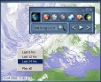
Environment Canada Satellite Images Widget v.1.4
Environment Canada Satellite Images Widget displays an animation of the latest satellite images of North and South America, including the North Atlantic and Pacific oceans.
MapSphere v.1.0.250
MapSphere is a mapping software for Windows that:downloads maps and SATellite Images from different sources (OpenStreetMap, Terraserver, LandSat, and others);stores all the mapping data on the hard drive for offline use;represents the map in 2D and 3
Satellite Image of my House v.1
View Satellite image of your House & Famous Satellite images taken from the free program earth explorer like the satellite image of michael jackson neverland ranch or the satellite image of andre agassi and steffi graf house.
RealMeteo v.4.15.5
It is a friendly realtime interface that shows weather images. Realmeteo has a wide database of weather satellite images link. Is a friendly realtime interface that shows weather images. Realmeteo has a wide database of weather satellite image links.
TerraLook v.1 1
TerraLook permits users to create their own collections of georeferenced JPEG satellite images. TerraLook images allow for visual interpretation and comparison without the need for complicated software.
BCF Weatherzone Tracker v.1.0
Weather Tracker is a desktop weather widget with live local weather conditions and 7 day forecasts for over 580 Australian locations. Features include live warnings, custom alerts, radar and satellite images.
Global Overlay Mapper v.1 5
Representing a new concept in the field of Ham Maps, the Global Overlay Mapping System is packed full of features for all Ham Radio enthusiasts, including : 1 World Map, with specialised satellite images and world region-boundaries.
Weather Pulse v.2.2.4 Build 4
Weather Pulse is a weather monitoring tool that that displays detailed weather information for selected US cities, as well as popular satellite images from around the globe. It includes weather alert options, 10 day forecast, hourly forecast,
TerraViewer v.1.1
TerraViewer makes use of Microsofts free TerraService web service to retrieve and display archived satellite images and topographic maps of any region in the United States. You can search for regions by long/lat values or by city names.
Webmizzle
Webmizzle is a simple tool for monitoring current weather condition. I wrote this program because I felt sick when I had to launch Internet Explorer and then browse through the ads and other crap just to see a satellite image or current temperature. And