Satellite Images
Advertisement
WinWeather v.3.0
A shareware program that brings hourly weather reports and forecasts, satellite images (and WeatherCams!), and ski reports to your PC!
Advertisement
Global Overlay Mapper v.1 5
Representing a new concept in the field of Ham Maps, the Global Overlay Mapping System is packed full of features for all Ham Radio enthusiasts, including : 1 World Map, with specialised satellite images and world region-boundaries.
NavTools Meteo v.4 14
Small and very easy to use application for retrieving worldwide weather charts, satellite images, radar, and hurricane information from Internet. NavTools Meteo uses ftp to download the raw data directly from major weather servers, resulting in a

Click Clock v.2.0.0
Click Clock is a clock, calendar, weather, and astronomy program. It shows your local temperature in the tray. It also shows local weather, animated weather radar, animated satellite images, date and time of sunrise, sunset, moonrise, moonset,
Weather Pulse v.2.2.4 Build 4
Weather Pulse is a weather monitoring tool that that displays detailed weather information for selected US cities, as well as popular satellite images from around the globe. It includes weather alert options, 10 day forecast, hourly forecast,
TerraViewer v.1.1
TerraViewer makes use of Microsofts free TerraService web service to retrieve and display archived satellite images and topographic maps of any region in the United States. You can search for regions by long/lat values or by city names.
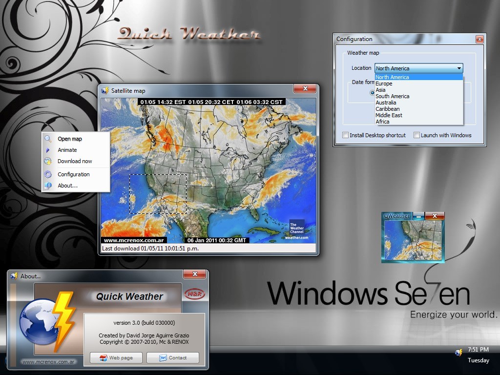
QWeather - Quick Weather 3.0 B030000 v.30000
QWeather shows the current Satellite images (sky and cloud conditions) (440x300 pixel).
X-Sat X v.1.0
X-Sat is a utility that downloads directly from the Internet the latest satellite images among a predefined set of areas (Earth, USA, Europe, Africa, Asia.
GeoSatSignal v.7.2.2.996
GeoSatSignal is a development of my SatSignal program, designed to process geostationary satellite data.
Webmizzle
Webmizzle is a simple tool for monitoring current weather condition. I wrote this program because I felt sick when I had to launch Internet Explorer and then browse through the ads and other crap just to see a satellite image or current temperature. And
HurricaneView v.1.5.98.9229
HurricaneView is a tool designed to automatically download and save images of tropical storm regions so they can be viewed as a time-lapse movie in a loop.